About
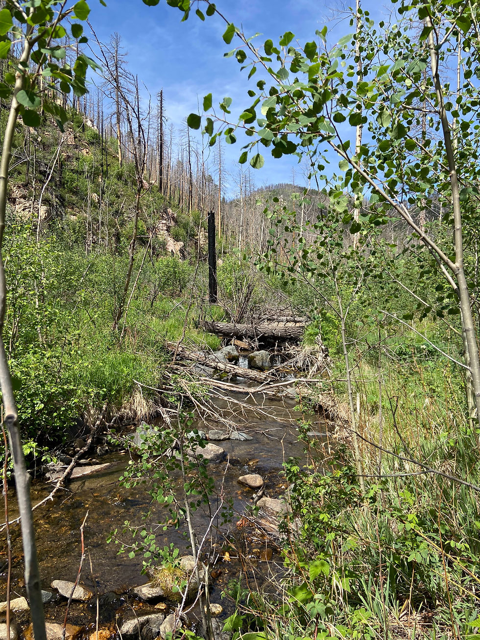
This project will evaluate options to provide safe, reliable, and resilient long-term access along NFSR 263 (Gallinas Canyon Road), addressing flood damage and existing safety needs.
The Federal Highway Administration's Central Federal Lands Highway Division (CFLHD), in partnership with the Santa Fe National Forest, is evaluating alternatives to reduce the road's vulnerability to future flooding and improve safe access through the canyon. No decision has been made, and the National Environmental Policy Act (NEPA) will be used to analyze alternatives.
Who is this project for?
Everyone who relies on Gallinas Canyon Road: residents, permittees, recreationists, landowners, and emergency responders. CFLHD and the Santa Fe National Forest are leading this road recovery effort.
Where is this project taking place?
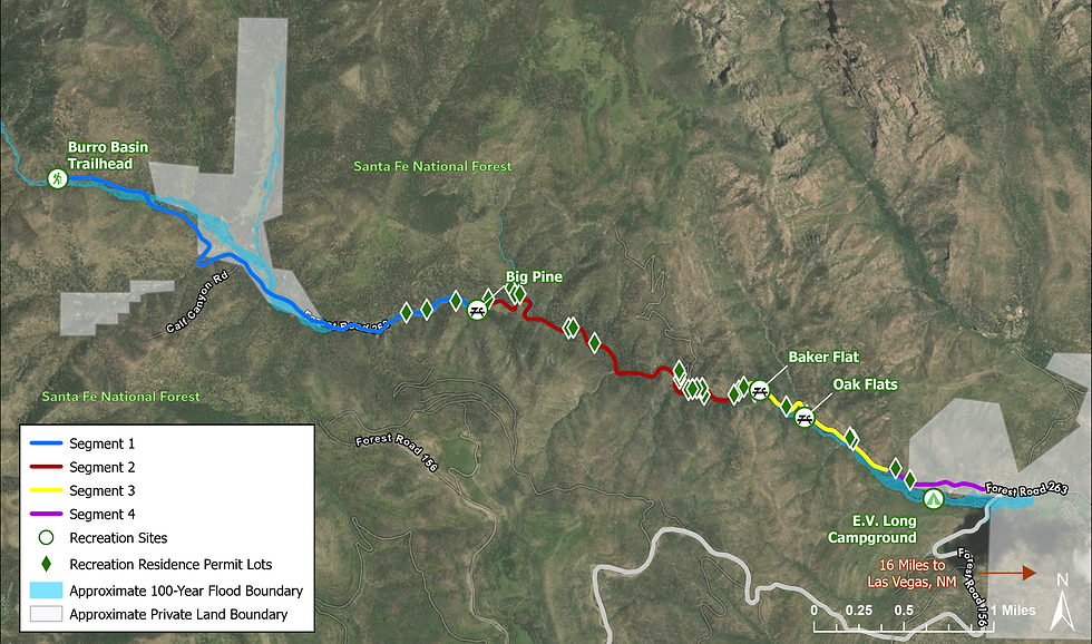
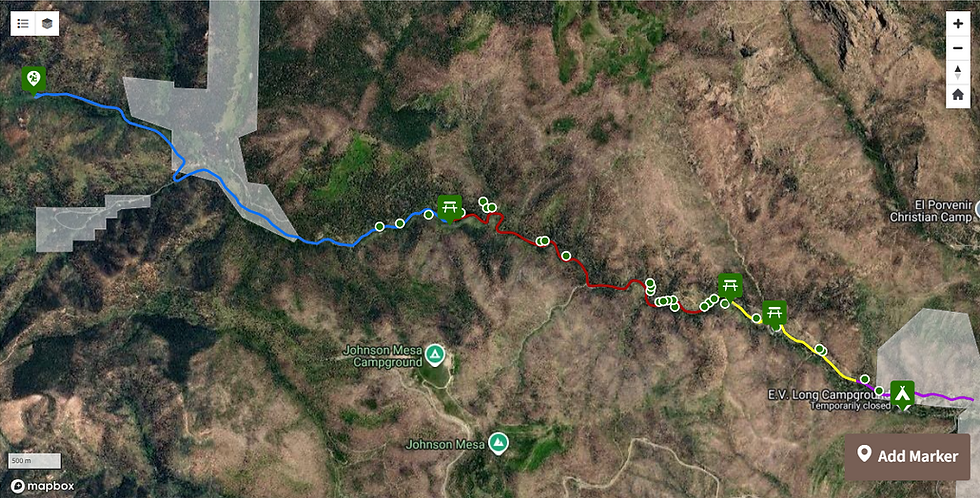
Gallinas Canyon, Santa Fe National Forest, about 16 miles west of Las Vegas, New Mexico.
Why are you doing this project?
The road provided the only public access to campgrounds, fishing, hiking, recreation residences, grazing allotments, and private property within the canyon. Emergency repairs are being used to maintain road connectivity; the road remains closed to use by the general public, and the road and bridges are vulnerable to future floods.
Project Timeline
January
2026
Project Kickoff
February - April
2026
Update hydraulic models,
develop initial
alignments
April
2026
Stakeholder Engagement
May - June
2026
Refine alignments and engineering
June
2026
Public Meeting
June - August
2026
Refine alignments and engineering
October
2026
Stakeholder Meeting (Virtual), Field Visits and Site Investigation (Workers on Site)
November 2026
Public Meeting (virtual)
Fall & Winter
2026
Develop report recommending alignment and future actions for restoration
Spring – Fall
2027
Design & Field Visits
(workers may be on site)
2027-2029
Potential
Construction
Project Area
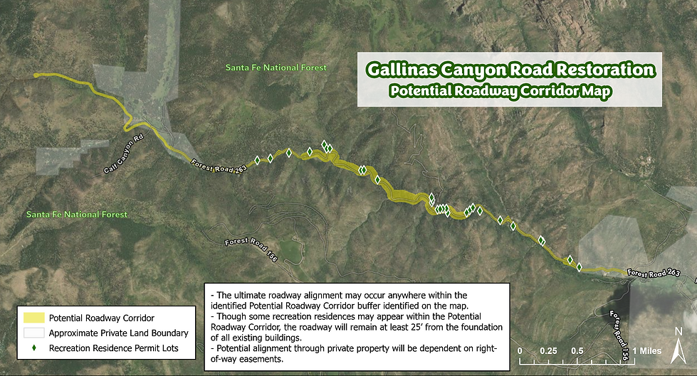
Potential Roadway Corridor
Get Involved

Fall Stakeholder Meeting
Date: Wednesday, October 14th
Time: 6:00pm – 7:30pm
Location: Virtual (by invitation)

Gallinas Community Meeting
Date: Thursday, October 15th
Time: 6:00 – 7:30 pm
Location: La Placita Fire Dept,
1059 Forest Road 263,
Village of Gallinas 87701

Fall Virtual Public Meeting
Date: Monday, November 16th
Time: 6:00pm – 7:30pm
Location: Virtual
Resources
Resources
Coming soon: Right of Entry Forms
Contact Us
Have something you would like to tell the project team? Fill out the form below to get in touch with us!
If you would like to receive regular project updates, please fill out the form below.